AIS = Automatic Identification System
Since last year we carry an AIS transceiver from Digital Yacht (AIT 2000) with us. It combines VHF and GPS information that tells us which ships are around us, at what speed, in which direction, what the closest point of approach will be, when that will be etc and also sends the same information about Tioga to our surrounding neighbors on the water.
Very useful information, especially in busy shipping lanes like the Channel. On sites like Marinetraffic.com you can get an idea as to how busy some areas really are.
We connected that transceiver to our wireless router (so that our iPad can receive this AIS data) as well as to our DSC VHF radio (so that we can see AIS targets on the radio display in the nav station as well as on the remote mic in the cockpit). An additional benefits is the fact that the AIS signal includes the target’s MMSI number (similar to a person’s cell phone number) which allows us to call a freighter, for example, directly via that MMSI number – rather than hailing everybody via channel 16 hoping that the particular freighter we want to reach actually responds.
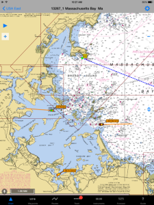
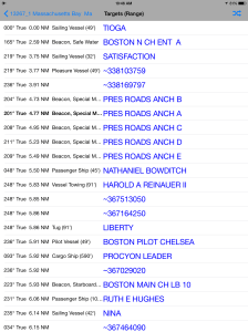
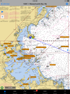
The nice thing of using an iPad for navigation is that it allows us to use the latest apps that were designed to combine AIS data with chart software etc. This is a very affordable way to get this done, compared to replacing our permanently installed navigation equipment on the boat. The screenshots below show iNavX (our navigation software) displaying AIS information around us in Nahant.
Another benefit is that these days a lot of “other” things are equipped with AIS transmitters, such as buoys, windfarms or oil platforms – all quite relevant for the upcoming trip through the North Sea. iNavX has the option to only show moving targets (first picture) or all targets (fourth picture).


Good luck.
LikeLike